MConnected and Inmarsat join forces with the European Space Agency (ESA)
The creation of INVISION-GIoT
The consortia mirror a ‘Remote Critical Infrastructure Monitoring Solution with Norwegian research lab and ESA.
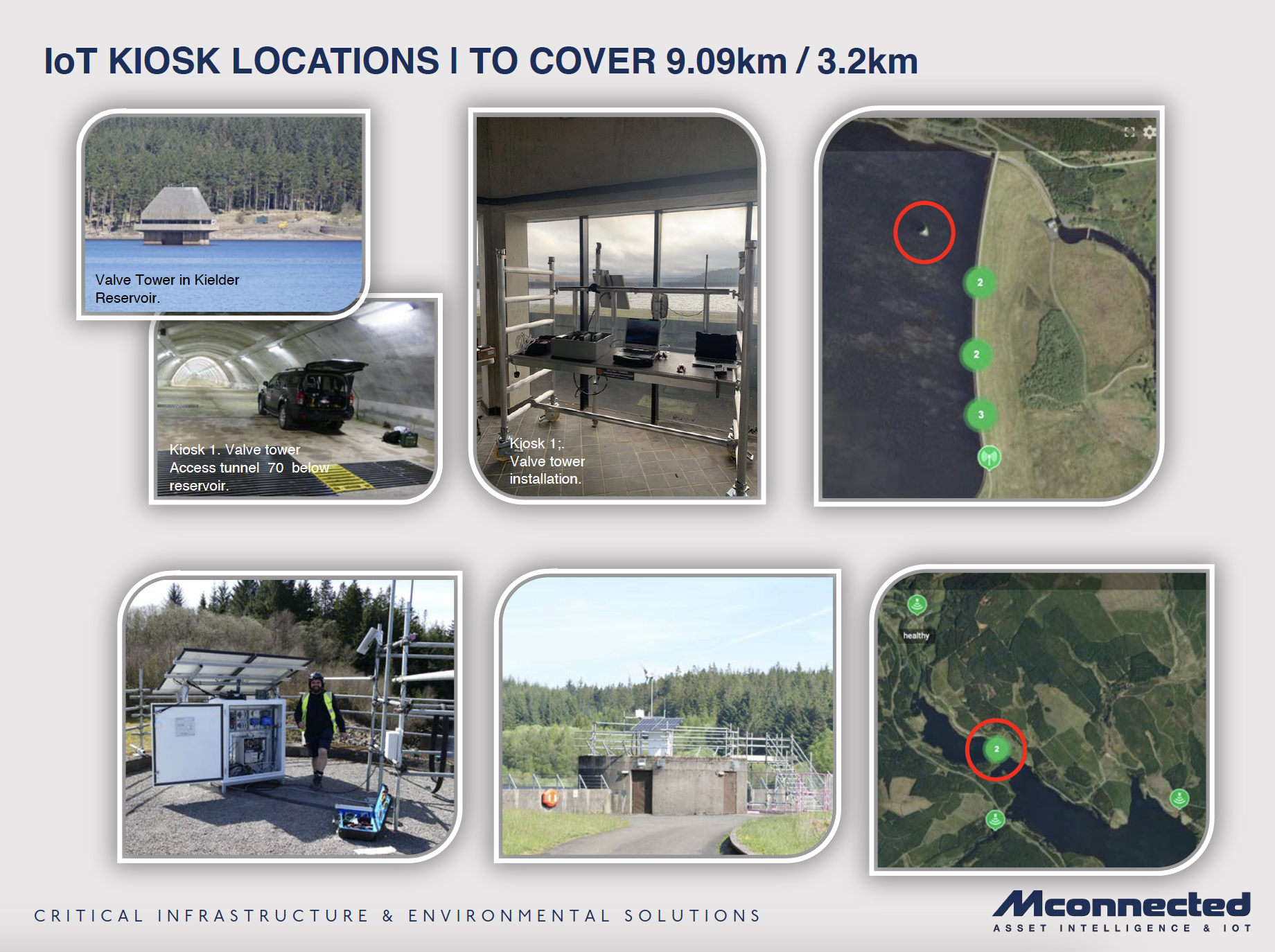
The main objective of the demonstrator in Kielder is to prove that that low power technologies can produce meaningful data to predict changes due to environmental factors in remote critical infrastructures. The technology has been proven to monitor critical infrastructure and geohazard events with the ability to provide predictive analytics-as-a-service. The data can then be viewed using the developed online dashboard via mobile phone, PDA and desktop. Alerts can be determined and sent to key stakeholders for appropriate actionable counter measures.
The project focussed on the safety and security and integrity of the dam in terms of 2-dimensional movement in conjunction of the charge and discharge of the reservoir. This was achieved by using a mixture of real-time small form monitoring sensors, which initially provided a “Base Line” assessment; this provided a critical reference point for assessing changes and impact, as it established a basis for comparing the data at the beginning and throughout the project.
To conduct such a project MConnected gained the support from the following end user stakeholders who are responsible for the area, forest, wildlife and surrounding land which is home to the rivers and tributaries that flow into the reservoir.
Forestry Commission England
Kielder Water and Forest Park
Northumberland Wildlife Trust
Northumbrian Water
Two important factors made Kielder an Ideal to test the project: firstly, it is remote with virtually no mobile communication and secondly the lack of grid power was a challenge to power direct satellite comms and the wide area links.
Quick Tech Overview - The pilot collected data from a range of industry standard sensors via edge connectivity and a LoRaWAN (Long Range Wide Area Network) before it is transferred across Inmarsat’s L-band satellite network to a single cloud dashboard. Sensors such weather stations, ultra-sonic height sensors and very sensitive tilt sensors, produced data at 10minute intervals. This approach gives the fullest view of conditions on the dam and is helpful to understand the trends and natural flex of the structure over time. Power generation used a hybrid of wind turbine and photovoltaic technologies especially designed for harsh environmental conditions which has been fully developed and tested. The cloud-based dashboard can be accessed via secure login and is built to be scalable to cope with new types of sensors such as piezometers and flow meters.